
All the bits you didn’t see in the video!

15 August 2017
Well, last Saturday the Full Version of our Scafell Pike video went live. Fantastic! And so I thought that today would be a great time to look back on the second mountain of our Three Peaks in blog form as a nifty little accompaniment to our vlog. How better to fill in the blanks and give you guys a more insightful look into the lives and minds of Summit or Nothing.
… Hey, where have you all gone?? Loloutloud!
It was booked months prior, a national trust campsite at Wasdale, at the foot of Scafell Pike (a campsite I found whilst researching in my copy of Britain’s Highest Mountain Walks) with dates being booked and unbooked and rebooked as Nath and myself realised that we had actually double booked with other engagements, but the people on the other end of my constant barrage of emails to the Campsite were always obliging. We settled finally on the date of Friday June 30th, and would be staying for three nights, giving us two full days to do some hiking and maybe some wild camping. It seemed like it was never going to arrive.
But as always, the day did arrive, and what was intended to be an early start, ended up being not so early after all, I think we left Nath’s at some time around half ten, meaning we should arrive at the campsite by late afternoon, enough time to set up camp and find a pub somewhere to eat. Leaving Cornwall via the A30, we soon joined the M5 at Exeter where we hit traffic almost immediately. What should have been a 6 hour journey was proving to disappoint, and as we watched the ETA on the sat nav moving farther and farther away from us, our aspirations of getting a nice pub lunch in the Lake District to set us up for the following day was becoming less likely.
It felt like we crawled all the way to the Lake District. Nath tried his hardest to stay awake and keep me company, but drifted in and out of sleep from time to time. That’s just Nath and that’s fine. Besides I had a copy of the hilarious Alan Partridge audio book (I, Partridge – We Need To Talk About Alan) to keep me company anyway. Although our family motor is a comfortable ride, I couldn’t wait to get out, and once we were finally off of the motorways and at the edge of the Lake District, it was already well after eight. We needed fuel, and stopped at a roadside garage where we both decided to grab something hot to eat too, to keep us going.

There wasn’t a lot left in the hot counter, and I debated for ages. When I finally settled on a rather disappointing sausage roll, I left the garage and noticed a pool of liquid running out from beneath my car. I dipped a finger in it. Diesel. I looked under and sure enough noticed a drip, drip, drip from the underside of the car. That was all we needed. Nath, being far more mechanically minded than me, climbed under the car to investigate. It appeared that the leak was only when the tank was full, as it dripped from a broken seal at the point where the services and gauges enter. No biggy, we’d stop and check again after a mile or two travelling and see if it had stopped.
We got back into the car, and I thought that I would phone the wife (on the cars new hands free kit) and tell her that there was an issue with the car, at this point this seemed like a wise thing to do, I don’t know why it couldn’t wait until we got back, but I did it anyway.
“Hi Don-Don, how ya doing? No we are still on the road. We just filled up and realised that the car is leaking diesel.’ Strangely, she seemed panicked by our news, particularly as she had a long journey to do herself the following weekend. Just as I was about to inform her that its not as bad as it sounds, we lost signal. And that was the last that we would see of any signal too for a long while. So the last she heard of us was that our car was leaking a flammable liquid. Hope she didn’t worry too much.
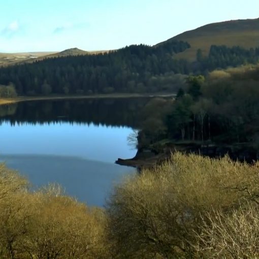
The journey through the Lakes to the campsite was exciting. Narrow winding roads for over an hour, interwoven between some staggeringly beautiful scenery. Over the next few days we would hear a lot of people moaning and groaning about these roads, and asking stupid questions to the campsite owners like is there any better routes into the campsite as that road was awful. – really? What do they expect, someone to demolish the natural beauty of this national park just to build a straighter road to the foot of Scafell Pike? We marvelled at the views, stopping at a vantage point over Wast Water to take some pictures and get a panoramic.

After 400 miles of bumper to bumper, and 11 hours in the car, it was practically dark when we arrived at the campsite. We had just enough time to set up camp in the dwindling light, but that left us no time to find a pub for a meal. We found a pitch under a tree to shelter from any rain that may arrive, we set up, unpacked the sleeping gear from the car and loaded the tent, then, out with the beers and a boil in the bag meal each and… relax. Well, relax as much as we could with all the midges that live under the tree we chose to shelter from. Little bastards! It was soon time to retire, and a fairly reasonable time to do so too.
I slept well. Well, as well as you can in the luxury of a tent. OK, so I woke up with a stiff neck and felt like I’d been beaten up, but as far as sleeps in tents go… I slept, at least. It was about 3 a.m when I heard people stirring in the tents around me. I don’t care how hardened you are as a hiker, 3 a.m. is ridiculous. It was still dark out. I nodded off again.
It was five thirty when I woke again. The sun was up. Dawns chorus had begun, and there was still bodies hovering about outside. I got up and made my way to the toilets for a morning wet, and thankfully, to offload the previous night and days food. That was a relief because although when nature calls you have to go where you have to go, lets face it, we all much prefer a toilet than a wildy. I passed Nath on his toilet run as I headed back to the tent. Good, he was up, we can soon get up and away.
We had breakfast, porridge cooked on the jet boil, and 3 in 1 coffee’s, all the while we supplied the midges with their meals too. We showered, changed, and sorted all of our gear, (as I put my boots on, I commented to Nath about how these boots have been a bloody good buy, having never given me a single blister or wet foot) and packed our back packs to the max with enough food and gear to spend the night out on top of a mountain somewhere as intended. Camera’s at the ready, we got the map out, set the Viewranger recording our route and by 7:30 headed up the Brown Tongue Path. We were off, another day, another mountain.

It was an over cast day, not too hot, not too wet, but a low lying cloud hid the tops of the surrounding mountains, which was possibly a blessing as Snowdon had been a considerably hard climb as we were constantly looking up to see just how far we still had left. That being said, memories of Snowdon soon began to flood back as the steady up of the climb began to take its toll.
We were both relatively pleased to see that the mountain side was well paved along this route, which still amazes me, the work that has gone in to putting these paths in is incredible. But, path or not, we were both beginning to consider dismounting and shedding some layers, but refrained for as long as possible as we passed ramblers on their way back down. It must have been some of those fools that got up at 3am to beat the crowds, although by the number of them, it seemed to me that a great deal of folk had the same idea. We heard someone saying that when they got to the top, they were in the thick of cloud, and not only could they not see anything, but they also got drenched. After that, we started to notice that a lot of the people on their way down were wet through.
I am the first to admit how unfit I am, and I could tell Nath was holding back to keep me company, but as is made clear throughout the vlog, we both become very conscious of our slow rate up the mountain, making excuses about enjoying the scenery. It must be frustrating for Nath to hold back sometimes, but he does, and I appreciate his company. Its always my chest that becomes wrought before my legs give way, and I fight for breath. That’s twenty plus years of chain smoking and zero exercise making its mark right there.
After a fork in the path, we crossed a brook, and continued up the mountain side, noting that it was getting considerably steeper. But, we noticed that as we climbed, the cloud seemed to climb with us, always keeping roughly the same distance above us. If this kept up, we could be lucky with the conditions of our summit. Also as gaining height our phones pinged to life, missed calls and text messages flooding in in a chorus of digital noise. Ideal. That gave us an excuse to stop, to phone home and let our women at home know that we had made it ok and our car hadn’t combusted mid conversation the previous night.
Where we had stopped, we were joined momentarily by two girls on their way down. I commented that they must have started early, for one to say, ‘we were on Ben Nevis, and going up Snowdon next’. They were doing a 24 hour challenge, but both seemed out of their elements, and miserable too. I tried to gee them on, saying that they were doing great and it would be an achievement they would never forget, all the while I was thinking how I wish I was fitter so one day I too could attempt it.
We walked for another hour or so, stopping at regular intervals, and we were soon off of the path, away from any greenery and in the new harsher environment of the clustered rocks that make up the top third of the mountain.

The view back down across Wast Water was epic, as the clouds behind us lifted, and even the cloud above us was dissipating, and revealing some tremendous mountains around us. Nath suggested we stop here, have a coffee and set up the time lapse to get some footage of the clouds over the lake below. It was a welcome idea. Gravity seemed to be adding pounds to our rucksacks as we made our way up.
The point at which we stopped was littered with cairn’s that we assume were to help with direction in the zero visibility, which surprised us as how easily navigated this mountain was, and Snowdon too for that matter, what with obvious paths leading up from the ground. Its very different to the bleak emptiness we tread on Dartmoor, where in the first sign of mist your bearings are shot.
Many walkers wearily trod on past us, a few would stop nearby and gather their own energy before embarking once again. We chatted to one couple who informed us that the weather was good for our summit bid, with a window of clear weather to be expected between 11 and 1 – that should have around the time we got up there, I thought about those who got up at those ungodly hours in the morning and made their way up the mountain to stand in the mist and the rain. Pointless.
We stopped for about half an hour and had a check of the map once again. According to the map we were about two thirds the way up now, but the remaining distance seemed to be a greater incline from here on, however, it was starting to feel as though we could see the Summit, or at least a plateaux that we assumed was the summit, and so we were driven for the final push. The sun was bearing down on us, and more layers were removed. At this point, Nath really started to push on, and he got a fair distance ahead of me, but this was fine, I felt like plodding, and to be honest, having him disappearing pushes me on, and means I stop less than I possibly would if he was in ear shot.

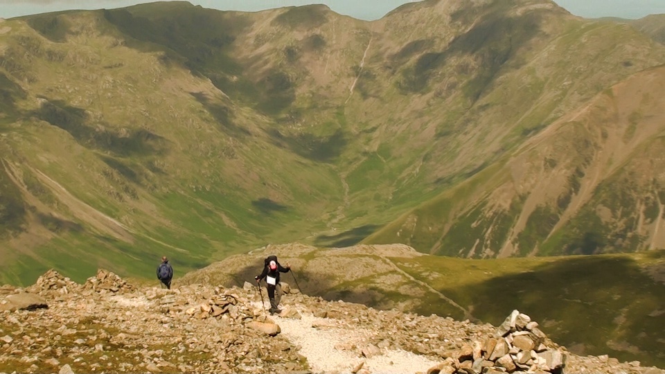
The (sort of) path we walked up began to get a lot narrower towards the summit, and we had to keep stalling to let the crowds on their way down pass. Many would profess cheerily, ‘nearly there now’, but it always seems closer on the way down when you’re moving so quick in comparison. Although it was a slog going up, and seemingly endless, I was still loving it. Just being UP there is enough to make your day. Looking down on those surrounding mountains that only a short while ago we were looking up at, not only gives you a real sense of achievement but also is just plain stunning to look at, the pics just don’t do it justice.
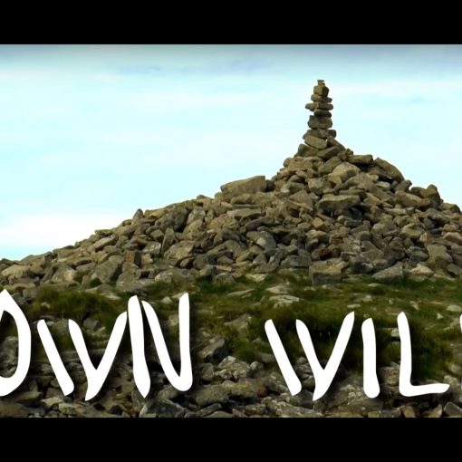
Two or three false summits later, and we finally made the top by eleven thirty, and those passer by’s were correct in their weather forecast, the cloud had lifted, and we were spoilt with some terrific panoramic views. We dragged ourselves to the summit cairne, amidst the many folk who gathered up there (not as many as Snowdon last year but still very busy), and armed with a camcorder each (one of which didn’t record), we let out (*a muted version) of our signature war cry of “SUUUUMMMMMIIIIIITTTT OOOOOORRRRR NOOOOOOTTHHHHIIIIIIINNNNGGG!!!!!”, to which we received a mixture of confused, amused and unimpressed looks from those crowds around us then we retired just below the summit for our celebratory gin and tonic and a boil in the bag meal cooked in our Jet Boil Zip.
On the way up, we had decided to pick of neighbouring mountain Lingmell as our next mountain, and then descend from there on. We had started to sway to the idea of not bothering with a wild camp as well (despite having carried all that extra weight up England’s tallest mountain), and just going for a pub lunch and an evening in the camp site ready for an early start for the next days hike, (still undecided but we were both sort of stuck on the idea of a hike and gondola ride around Coniston Water). So, after a good hour of calm and relaxation, we once again began to make our way back down the mountain (cheerfully professing to those on their way up that ‘You’re nearly there now’), and headed towards Lingmell.
Lingmell is an impressive mountain compared, obviously compared to those tors that we have conquered on Dartmoor. From the campsite its lower section towered over us, its steep green hillside reaching far up into the clouds this morning as we left camp. But when you’re up with it, from the valley where Lingmell meets Scafell Pike, the climb was considerably easy, much like a climb up one of our familiar tors, and so within another half hour or so, we had summitted our second mountain of the day and still under the clear sky .

This seemed the ideal place to capture a shot of Scafell Pike from just below the summit, something that we could use for the opening shots of our video, so I got out the Canon DSLR and time lapse remote do some more time lapse photography, capturing the clouds moving over Scafell. For Nath, this was the ideal place to catch a few Z’s, so he lodged himself into a cluster of rocks, and hunkered down whilst I titted about with the camera, and admired some of the scrawling views.
So preoccupied with the views to our East, I failed to notice the low, black clouds swooping in on us from the west, until they were practically upon us. It was literally panic stations as we threw our packs back together and prepared to get the hell off of Lingmell ahead of the weather, but it was too late. It was over us as soon as we were about to set off. Zero visibility, ideal. Our favourite conditions.
It wasn’t long before Nath, taking control of the map, lead us off of the mountain, heading for what we believed to be Goats Crag. We were walking for ages and I began to get that inkling inside me, (that many call paranoia, but I like to refer to as a six sense) that we were heading the wrong way. Nath is storming ahead of me, hollering for me to keep up, as he starts to fade in the mist, but I’m stalling, peering into the mist to see if anything stands out. Eventually, I holler back at him to wait.
We examine the map, Nath pointing to ‘the only set of rocks between us and the campsite’ so therefore it has to be Goats crag. I point to another set of rocks to the North of Ling Mell, known as Lingmell crag, and say, ‘You’re sure we’re not there’. Nathan is losing his patience with me here, I can tell, as I try to counter his directions again, and is just about to prove with use of a compass that we couldn’t possibly be at those rocks as we are heading due…

“Oh,” he says holding my compass to the map. “Your compass isn’t working!” He tries his too, and then realises that he has been leading us the wrong way afterall. We laugh, and joke, because if we didnt we’d cry, and try to amend our route, Nath with the map, me with the use of the ViewRanger that’s been recording our journey in my pocket. It was around then that the cloud lifted a little beneath us, and we struck with the amazing but terrifying sight that was Wasdale beneath us, a looooong way beneath us, as we were stood on what was a sheer drop, one that we had been walking towards as well.
I don’t know why, or how Nath always gets the map, I think its a mixture of the fact that he likes to take control and I lack the confidence to do so, even at times when I take the map in the beginning, we somehow end up swapping over. As a result, it always seems on the videos that Nath is a poor navigator, whereas he isn’t. He has successfully directed us around Dartmoor before, even in low visibility. Ok, so perhaps he doesn’t check the map and compass as frequently as he should, but there are two of us up there, and I should also share the responsibility of navigation.
Tempers were rising as we struggled through the mist, I was getting a little down trodden, and as luck and misadventure would have it, my boots began to fall apart. With another two thirds of a mountain to climb down with a flapping sole hanging off my boot, (yes, the boots that only this morning I was only commenting on how great they have been, never leaking, never giving me blisters), it is no surprise that by the time we found terra firma, my feet were absolutely wrecked, and riddled with sores, and blisters.

The climb down was incredibly steep, and dampened by the cloud and rain fall, it was a little greasy underfoot. The loose stone paths, however, seemed more dodgy than the grass, and I almost lost my footing several times. Nath, at some point done a mischief to his knee. The sign for us at how steep the hill was, was how strange Wast Water looked from our perspective, it looked like a diamond, stood upright from one corner, rather than a lake reaching out away from us.
In the pouring rain we finally arrived at the bottom of the mountain, delirium kicked in for me, as it often did as the adrenalin of a mountain hike flooded through me. I go a bit nuts after every mountain, its no lie, and this time was no exception. I bombarded Nath with a series of manic knock-knock jokes as we walked the final furlong. The relief to be finally off was huge, and when we looked back up the terrain we had just walked down, it made our eyes bulge, it looked too much, too ‘vertical’. We just walked down ‘THAT?’ I stopped the ViewRanger; 8 hours on the mountain and an unimpressive 6 miles walked. It felt more, I guess the up culminated to more, but still, it seemed a little depressing.
But, we had done it. Mountain number two knocked off. What started out as the superb conditions that we had met at Snowdon, soon deteriorated fast and became more like the conditions we faced at Tryfan. So, one summit left to be able to say we have finaly finished our first personal challenge, and the harsh reality that we have to a)get fitter (as Scafell Pike is 367m shorter than its Scottish cousin) and b)we need to brush up on the map reading skills – not just Nath, but me as well. We both need to take the responsibility.

As soon as we were down, and the accomplishment began to kick in, the misery of the past hour or so began to fade rapidly, and by the time we were sat in a pub, gouging on a massive meal and drinking real ale, we could only look back through rose tinted glasses. Funny how you soon forget the bad times, or is it? Do we merely put ourselves through those time to achieve the greatness of standing up above the world, enduring the pain and hardships is part of the process. They do say no pain, no gain, after all.

Leave a Reply