
MAY 2016

This 8-mile walk on Dartmoor National Park enters the Wislworthy Range, so it is worth looking up whether or not there will be any military exercises taking place on the day you wish to partake.
This was an early walk of ours, so its more obscure, and not well tracked, with River crossings, bee-lining between destinations over arduous and dodgy terrain, so this is definitely for the more adventurous of you out there.
This walk takes in 5 squares of the Dartmoor 365 map (buy your own copy of the Dartmoor 365 book here) – I4,I5,I6,I7 and I8.
Our second outing onto the moors was to find Cranmere Pool, Dartmoor’s most remote location. If you are familiar with our videos, then you will be aware that on this occasion, we did not find it, but instead opted to take in Fur Tor, Dartmoor’s most remote Tor. In all actuality, when you look at how far we were from Cranmere Pool I think that you will agree that we were being a tad ambitious with regards to our starting point.
But, before I get on with the hike in hand, let me once again advise you that any walk on the moor is dangerous if not taken seriously, so please ensure that you have an OS map and compass before you set off. In fact, it was on this very walk that I first realised just how easy it can be to lose your bearings, as when on Fur Tor, and working out where we had come from, I was completely shocked to find it had been from the opposite direction than I believed it to be… And this was on a clear day too.

This is an 8-mile trek, and the main bulk of it is tracking alongside the River Tavy, so, for the most part, it is at low levels, but there will be a considerable climb up some very hard going ground to reach the top of Fur Tor which sits at 569m above sea level, and a climb of over 130m respectively. Anyway, let’s get on with the walk.
1. Park at Lane End at Wilsworthy. As with the last walk, this is once again in the danger area – this time Wilsworthy range – so its best to check Dartmoor Firing Times online before you set out to ensure that there are no military exercises. Head East out of the car park and down the farm lane, until you enter the moor – you will reach the leat. Follow this for some time.

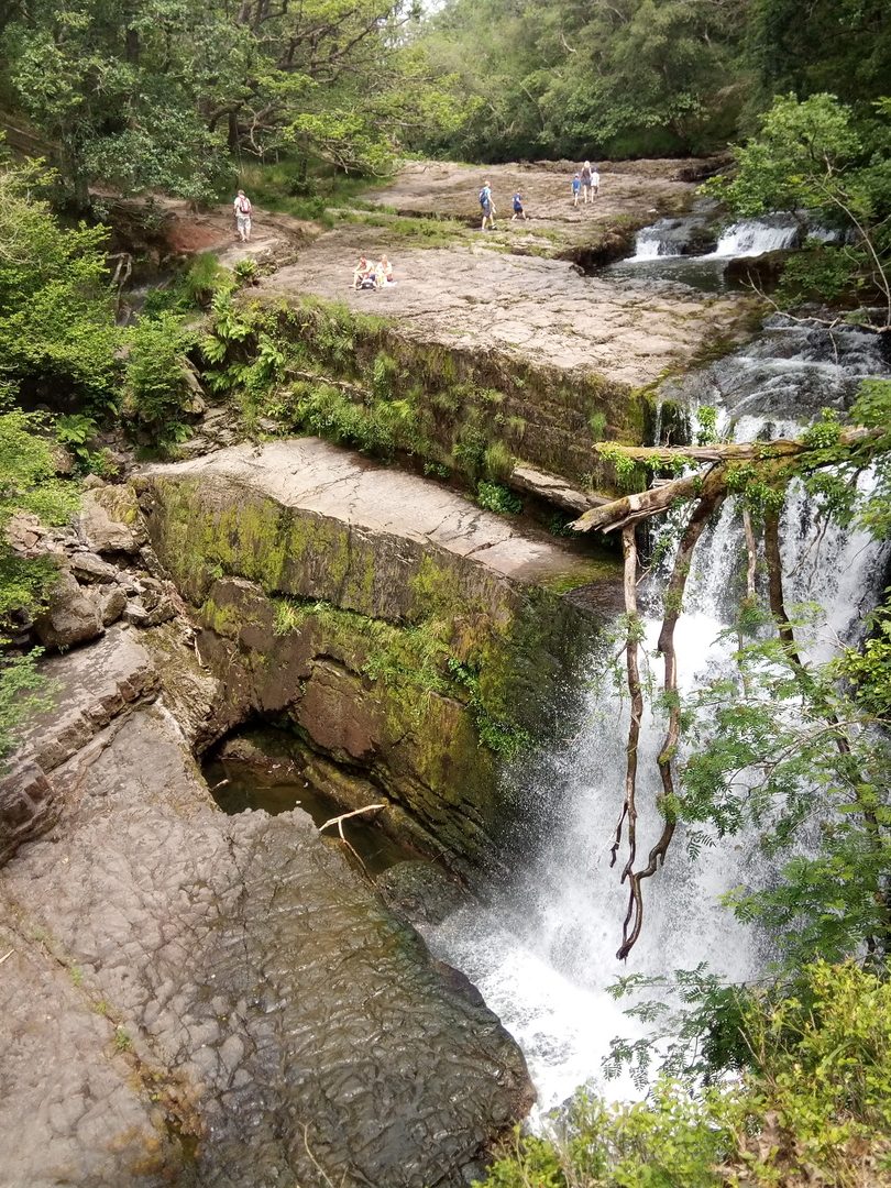
The leat runs through the Tavy Cleave valley, winding beneath Nat Tor and Ger Tor, where the leat meets the river. You should start to follow the river from here. There are some beautiful spots along here, with picturesque waterfalls, so be sure to keep your camera handy, and whilst most of the track is obvious, there are some patches where you will require scrambling over rocks and picking your route carefully.
2. Follow the River Tavy for just over 2km from Ger Tor until you reach a T in the river, this is where the Rattlebrook runs in. Follow it around to the right along Amicombe Brook. We stopped for a spot of lunch among some rocks at the very far end, opposite The Meads on your OS map. This is where Nath first tested his MSR Reactor, a super-efficient and fast boiling stove that he purchased.
It had taken us a good few hours to reach this point, and we worked out we had the same again to go to reach Cranmere Pool – so this is where we decided to go up Fur Tor.
(If you do want to take on the challenge to reach Cranmere from here, you simply follow the Amicombe brook to where it forks into the Black Ridge Brook and follow that for about 4km, keeping Little Kneeset on your right, and Great Kneeset to your left. When the brook begins to fade, travel NNE for roughly one more km (through wet marshland so take your hiking poles) and you should find it.)

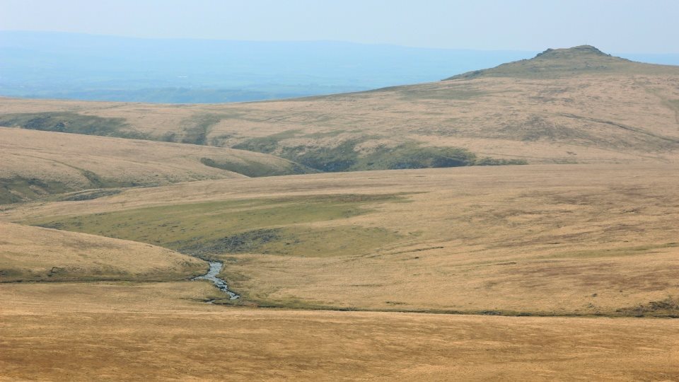
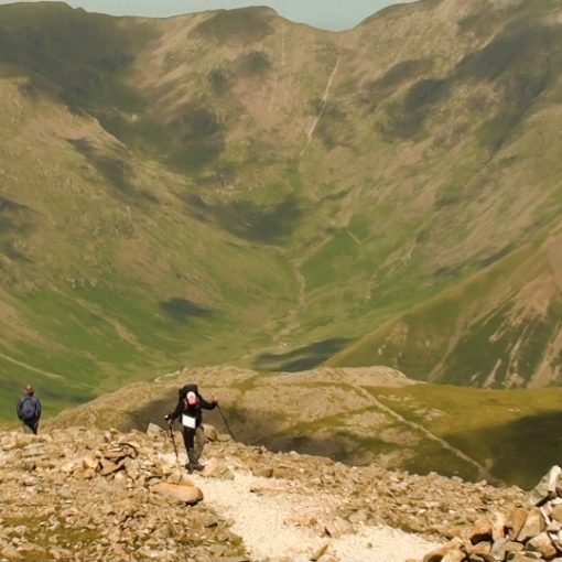
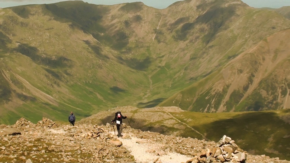
3. Fur Tor is ESE from this spot and stands lonely but towering above. It’s about 4km from the rest spot opposite the meads, and is a constant climb, so be prepared for some hard exercise here, and to question why exactly we do these things. But fear not, soon you will be up to the top, and the answer is in the views – unless it’s misty, windy and wet, in which case you probably still asking why we do such things.
4. From on top of Fur Tor, take a bearing. You can either make your way back down and follow the river back to the car park or you can do what we did, and go in as straight a line as possible back, in which case, in good visibility, use Brentor Church (a nipple on a hill from here – WSW) as a marker to take a bearing from and keep on that baring, as the car park is roughly in line with that. But be warned, the Church will drop out of sight so it is important to stay on the baring.
The walk back is across some pretty arduous ground, but it’s a straight line… Always quicker…. Right? Right? We thought so, and as far as a lot of our straight through the middle walking goes this one wasn’t too bad, but feel free to change things up anytime you want.

Eventually, you will rejoin the river, we did have to clamber down a steep hillside, with rocks woven into tussocks . We came down in front of Ger Tor and could see the leat once again. Simply cross the river in a safe spot and follow the leat East, back to the farm and the car park. Easy.
So, that was the route we took when we first tried to find Cranmere Pool, and when we successfully summited Fur Tor. If you would like to take the route, feel free to print this page out, but if you would like to change it somewhat then feel free. But once again, I can’t stress enough how important it is to take an OS map and compass with you on any outing to the Dartmoor National Park. Enjoy yourselves, but stay safe!
And if you fancy joining us on our journey, then please feel free to watch the video below.
Subscribe To Summit Or Nothing On YouTube
Leave a Reply