
During lockdown, whilst we were all forbidden to visit the moor, and wild camp, I had the mad idea that once we were allowed back out, that I would take a weekend to stroll across the moor, from one end to the other, camping en-route.
At somepoint, however, I decided that I would forget the camp, and see if I could walk it in a single day and raise some more money for Hospiscare, a local charity that I am currently in the midst of fundraising for.
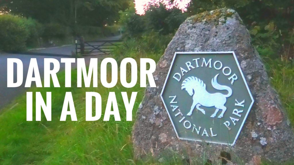
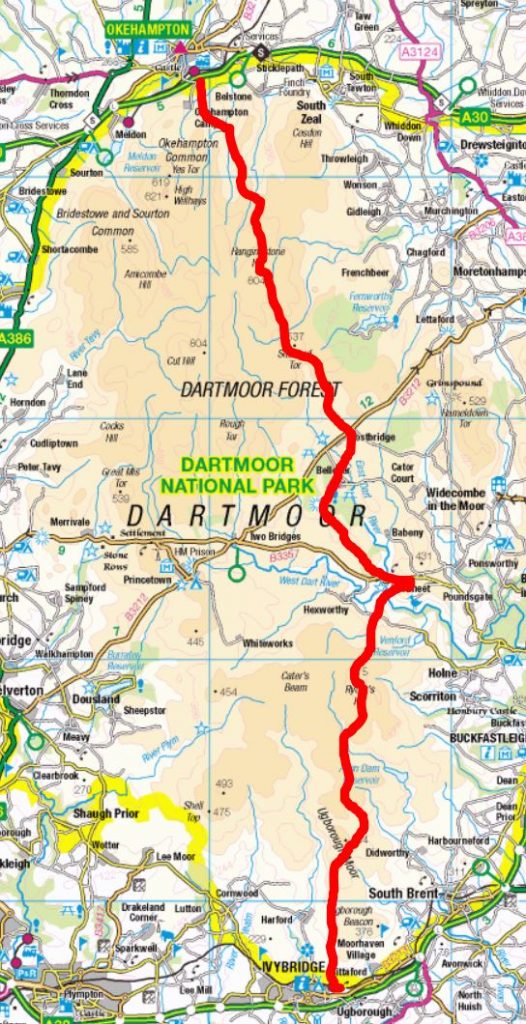
Well on Sunday the 2nd of August, at 4.30am, I woke, ate my breakfast, donned my backpack and set off on my solo journey across the entire length of Dartmoor National Park. From Okehampton to Ivybridge – my epic solo journey began. I was about to hike Dartmoor in a Day.
You can watch the FULL VIDEO of this hike on the Summit or Nothing YouTube Channel
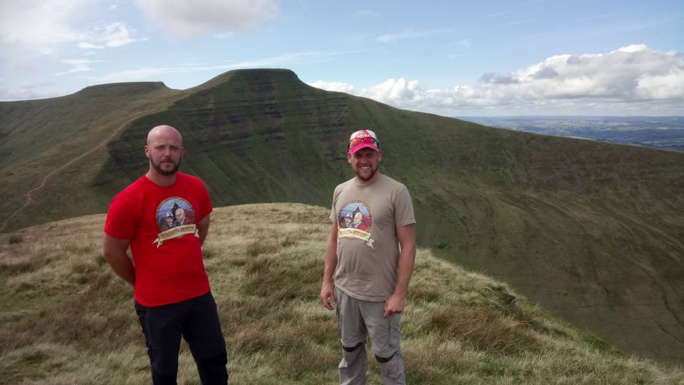
It all started a little less than a year ago, when I was invited to join an organised charity hike across Dartmoor, but other obligations on the same date meant that I couldn’t take part. However, I had managed to download the hiking route on Viewranger, and often looked it over, toying with the idea of doing it one day.
By the time I had decided to finally do it, during our national lockdown, I had gone over the route on my Dartmoor OS Explorer Map – making a few alterations here and there to suit my location. Then it was a case of getting in some training.
Upping the length of my walks, I began my training in earnest on Dartmoor, getting used to the terrain. I had been blessed with a particularly dry spell, however, and was getting a bit too cocky when Dartmoor raised her head to teach me a valuable lesson. It only took one particular route to knock my confidence for six.
I was exploring the open moor behind Beardown Tors when the weather turned, visibilty reduced to a matter of metres, the tracks that I followed disappeared and turned to swampy bog, and my skill with a map and compass (or lack of) practically had me walking in circles.
Although I would be following a route on Viewranger, Dartmoor is not to be taken lightly and technology is not to be rlied upon, so I began to look more closely at the OS MAP, and even bought an incredible book to help me get to grips with my navigational skills – The Ultimate Navigation Manual by Lyle Rotherton.
Then, I kept an eye on the weather until the conditions looked just about right….
Sunday – 2nd August 2020
4.30am – my alarm sounds, I am practically waiting for it and stop it before it wakes my wife. I get dressed and make my way down stairs where I drink a pint of water, a cup of coffee and have me a large bowl of porridge oats and golden syrup and down one more pint of water as I set out.
My backpack (Karrimor Jura) is already packed and is close to 10kg’s, despite having left behind a shelter, sleeping bag and anything I should need in case the shit hits the fan and I need to stay out…. I’ve decided that I need to plan for getting this done in a day. I think the weight is mostly excessive food and drink. I probably don’t need so much, but I’ve panicked. My lack of confidence is the one thing that prevents me from keeping my pack weight down as I tend to pack for every eventuality.
I have snacks, trail mix, sweets, protein bars, jerky, energgy gels, fruit, peperami, coffees, and a dehydrated adventure meal, plus two bottles of water and two little bottles of lucazade sport …. I will need the energy… but I know I’m going to be bringing most of this back.
The backpack is new, and affordable, another budget product that I intend to test… perhaps today is not the right day, but as I leave the house, I guess it’s too late to change my mind.
I am wearing my Solomon boots – they have done me well so far on the trail – they are lightweight (ideal for a longer trek) and got me through the snowy mountains of the Romanian Carpathian’s with dry socks, so I have confidence that they will fare OK on Dartmoor.
5:00am – I leave my front door and head up onto Dartmoor. The walk to Dartmoor from my house is a mile and a half at least, and it is all uphill, in fact, the first several miles or so of the walk are all up hill until I reach Hangingstone Hill.
It’s still dark. but the sky is slowly illuminated as the sun makes its way around the Eastern side of the globe. I have hiking poles, and a mono-pod to attach my camera to. There will be no time to stop and set up tripod shots today.
5:24am – I finally reach the granite slab that indicates the start of Dartmoor. I am already exhausted, hot and bothered after such a hard climb.
I take my jumper off, shove it into my already over-packed backpack, set my Viewranger going, film a quick introduction at the Dartmoor sign, then cross the cattle grid and set off in earnest!
I am excited, but also anxious…
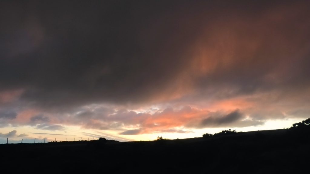
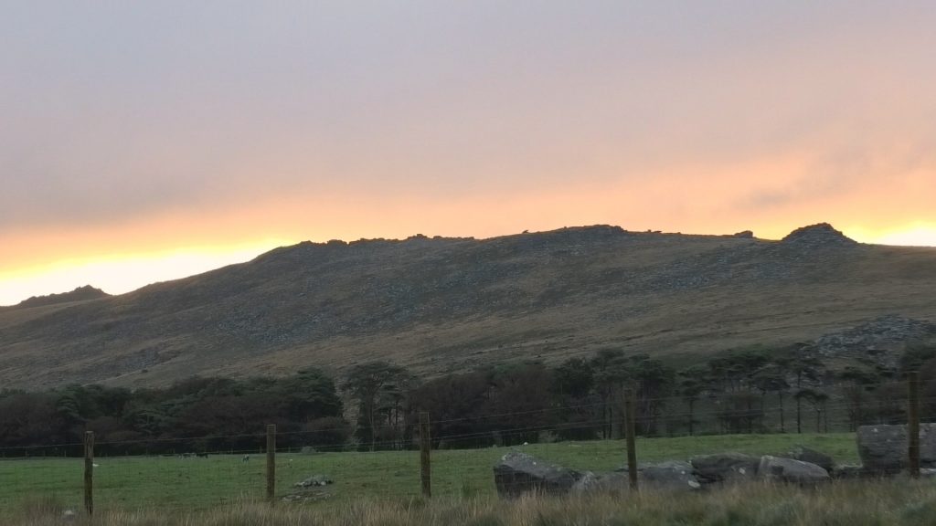
The dawn light begins to emerge from behind Belstone Tor to my right, the low hanging clouds to my left shroud the top of West Mill Tor, and completely engulf Yes Tor. This cloud is my main concern. Some of my route navigates some pretty featureless marshland, and with zero visibilty, it could be a repeat of Beardown Tors. I can not afford the extra mileage today.
5:59am – I pass by the base of Rowtor. I am not going up any Tor’s today, but will use them to measure my progress as I pass them. I jot the time in my waterproof notepad, purchased just for this very event. At the fork in the track, I veer left passing East Okement Farm. The sun is rising now, golden light cuts across the moors under moody clouds.
Rain spits in the air. I put on my waterproof jacket, and cover my backpack. I am expecting to have a spot of rain (as forecast) for the next hour. Rain, I don’t mind so much – its the cloud that comes with it that worries me.
6:20am – I pass beneath East Mill Tor now. The clouds are getting heavier around me, but my path winds clearly ahead of me. It still hasn’t really rained yet. I begin to notice that something is digging into my back from within my backpack, its not painful (yet) but is beginning to niggle me. I ignore it for the time being, and keep plodding on. I begin to suspect that it may be a part of my backpack. I hope not.
The track has levelled off somewhat and I gather a good marching pace.
6:36am – I pass the track to Oke Tor on my left – the sun rising behind the tor sheds golden streaks across the flank of East Mill Tor. It still hasn’t rained.
7:08am – I have cut back in towards Steeperton Tor. There was a moment where I lost the track, or the track stopped being a track, and I had to scramble downhill over ankle snapping tussocks. Until this point I had been stomping on at a considerable pace, but when I lost my footing in a hole I couldn’t see, I slowed a little.. now is not the time to roll my ankle.
I’m soon down in the valley and making my way alongside Steeperton Tor in the same riverside valley where I noticed I had lost my sunglasses the last time I was here.
7.27am – Hangingstone Hill comes into view ahead, the highest point on the horizon. As I am gaining height, the wind seems to pick up.
7:41am – I leave the stone tracks, and head up the long steep bank towards Hangingstone Hill.
7:50am – I have reached Hangingstone Hill. I am 6.4 miles into my walk, one fifth of the way there. I look around me, there is plenty of heavy cloud rolling in as I contemplate the marshy terrain I am about to embark on. This is all new territory to me and on the map looks like it could be another Cranmere Pool. I get my hiking poles out, don my gaters (somehow a mismatched pair) and prepare for a bout of clod-hopping across the next few miles.
I take a minute or 20 to have a drink, a snack, I get my hiking poles out, swap camcorders, put on my gaiters. I also rearrange the backpack, it seems the lip of my Jet Boil was digging in my back after it had somehow dislodged from its place. I shove my down jacket between my belongings and my back. Issue resolved!
One last look behind me at the landscape that I am all too familiar with.
8:11am – I set off towards White Horse Hill. The terrain is surprisingly friendly, firm underfoot and the path is pleasantly apparent. I make my way through the Peat Pass – and the memorial stone that informs me that Frank Phillpotts constructed this pass to aid farming and hunting…. and hiking too, it may seem.
Wild Tor, Watern Tor are in view to the East, and fiurther still are the forest of Fernworthy, and the prominant Kestor Rock.
8:52am – I reached Quintins Man Cairne having passed over the featureless White Horse Hill without really noticing. I don’t really stop at the Cairne but head down towards Little Varracombe, and follow the wall that will lead me to Sittaford Tor. I am about to write my mileage and the time in my notepad when I realise that I have lost my pencil. I use the Staedtler wax highlighter pencil that I have bought to mark my map from here on.
There are 22.8 miles left to go
The next mile is a quick descent into the dip of Little Varricombe, and then a laborious climb alongside the wall to Sittaford Tor.
9:20am – Sittaford Tor -21.8 miles to go, so half an hour to cover one mile. But it was pretty much all uphill. The views of my journey ahead begin to open up – I can see Bellever Forest.
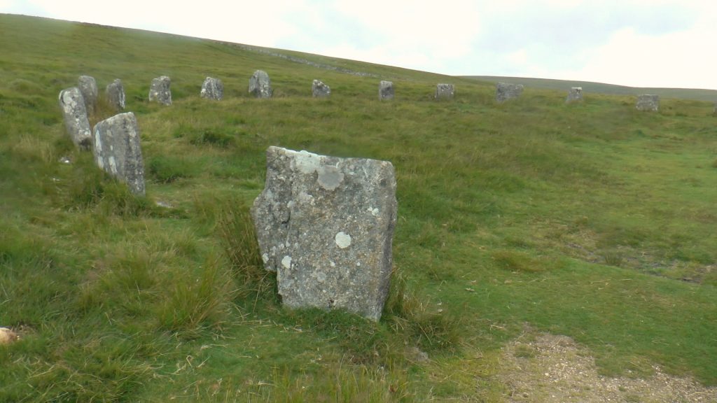
9:35am – I arrive at Grey Weathers Stone Circle, a happy accident as the route was supposed to bring me out beneath them, but I had picked up the only track visible in the direction I was heading and it must have been the wrong one. Regardless, not much distance out of my way and I got to pay a visit to these stone circles.
This is a new area to me, but the girls Don and Gem had visited this area in their own adventure which we called Struggling For Nothing!
10:26am – I reach Hartland Tor and 19.6m to go. The last hour was a long and confusing slog down a riverside valley. I ended up on the wrong side of the river, but it was a generally decent path so I stayed on it, I was at least heading in the right direction and as far as the map was concerned I looked to get a chance to cross again.
Once I crossed the river, the path became an overgrown track that wove through the gorse. I preferred the other side.
Anyway, now I stop for quick refreshments on the side of Hartland Tor – I am higher than I should be. I winder if I am still on track to make the rest of the walk before the dark, I feel that the time lost in that river valley could be costly.
At least the weather has been fine and the clouds seem to have dissipated for now.
The closer I get to Postbridge, the more people I see dotted about here and there.
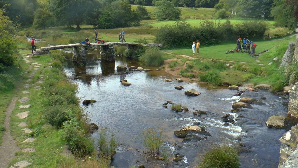
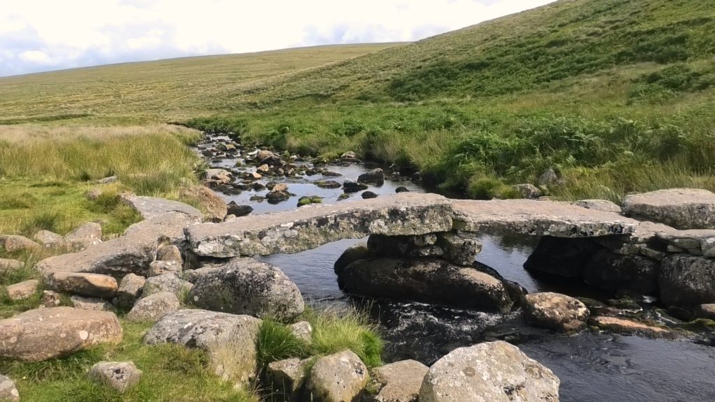
10:51am – Postbridge – 18.7 miles remaining. I take a quick look at the clapper bridge but only from teh roadside. I swap cameras and continue en-route. There are lots of people around here.The little store is queued back to the road. I head into Bellever Forest from here and start the long climb up through the forest.
11:35am – Bellever Tor. I have practically climbed to the top before I find a track that takes me down the side. I was going to stop here for some dinner, but I am not hungry. I just take more snacks out of my bag and load up pockets. I also get my trusty Pebble USB charger out and start to charge my phone battery, and I replace one hiking pole with the monopod and set off.
There are 17 miles remaining.
12:07pm – Laughter Tor Standing Stone – I am getting fidgety, hot and restless. I have an ache on the top of my left foot which seems to be dull for the most part but occasionally ramps up to sharp… my mini USB charging cable keeps falling out of my phone every 30 seconds, and my hiking pole and monopod set up is in the way when I try to reattach it. I’m hot, I feel I have lost a lot of time between Grey Weathers and Postbridge and feel the need to rush.
There are 16.2 miles to go – I usually have a wobble towards the middle of most walks I do. I hope this is it! A deep breathe and a bit of positive reassertion and I am good. I’m on the second half of the map now, and its not even 1pm. I’m doing good.
12:40pm – I reach the road by Huccabby Cottage. During the last stretch between the standing stone and here, I lost the track completely, but as the weather was clear I was able to see the shape of the treeline ahead of me and could easily identify the corner of the woodland that I am heading for. I kept to a track that appeared to be heading in that direction.
The road is only small, just enough room for two cars to pass, but not when there’s a hiker on the side of it though. And cars fly down here, and plenty of them too. I am glad when I get off the road again. Thankfully I’m not on it for long.
13:00pm – I reach a ford with some fantastic stepping stones, known as Week Ford. It appears to be a popular spot, so I guess there must be a car park relatively close by. An elderly woman paints, an older man is snorkelling, and children paddle and wade in the pool. There are a few families, and visitors here, having their lunch by this picturesque damned pool. I decide to do the same – well, it is 1:00pm bang on!
I chat to a family next to me, who say I look professional… as I drop down my belongings I can’t help but laugh, I feel like a one man band clattering and rattling about with poles and wires flapping around me. When they ask where I am heading I tell them that I am walking Dartmoor in a day, they seem impressed and I soon fill them in with details about Summit or Nothing, and the fundraising I am doing. They say they will check the channel out.
I have a sandwich and a protein bar, but cannot face eating my Adventure Meal, I really have no appetite. The hot coffee from the Jet Boil goes down well though.
I take a baring from the map to find my way out, and am happy when the family point me to that exact same path when I tell them I am heading to Combestone Tor.
It starts to rain quite heavily, I pack up, put my waterproofs on and at 13:26am head off to find Combestone Tor.
Within minutes of leaving, and as i slog up another steep hill, the rain has passed and the sun has come out. I am now overheating as I trudge up the hill and am glad that I have all these additional layers on.
13:51pm – I reach Combestone Tor. This is a Tor I thought I had visited, until I arrived here. It’s right next to a car park, and I have no recollection of it at all. In fact, a lot of this area is going to be new to me from here. I am pretty sure I can make out Sharp Tor and Mel Tor in the distance, from when Nath and I walked the Dartmeet area.
There are 13.2miles to go. I am now well and truly into the second half of the journey.
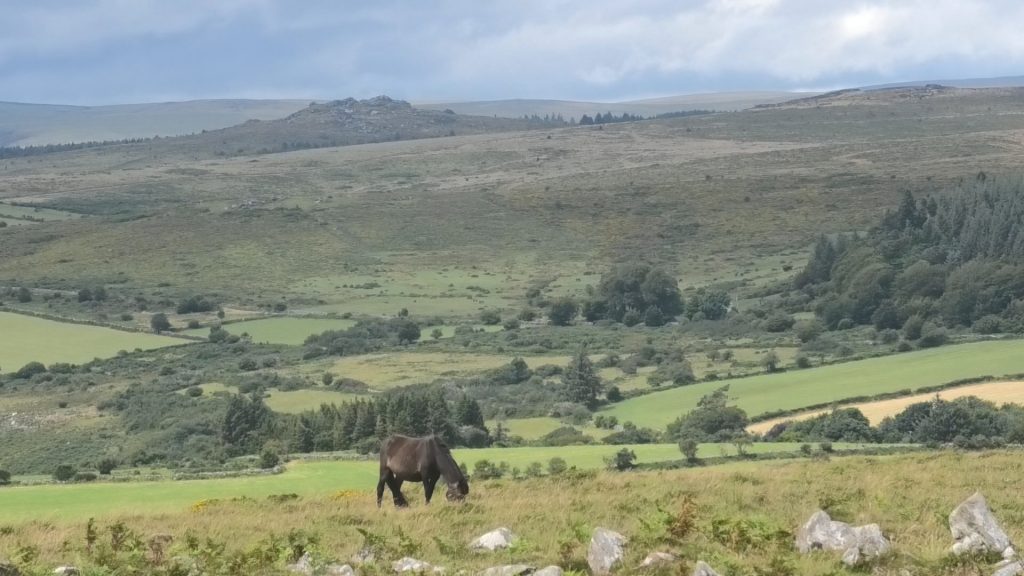
I set off now on a loooooong climb!. At Combestone Tor I stand at 350m’s, and over the next 2 or 3km’s over Holne Ridge, all the way to Ryders Hill, I will gain over 150m’s. The climb is long, and hot. But the views of Venford Reservoir and Haytor open up in the distance, and behind me too the open moorland that I have travelled across seem’s vast and unfathomable.
14:48pm – I reach Ryders Hill, a remote area with a trig point, a boundary stone and a marker all sat beside each other. As I arrive I am joined within minutes by another family. They have come from Snowdon and Pupers Hill, where I am off next, and they inform me that is horrendously boggy.
I tell them of my challenge, and they all seem genuinely excited for me, the dad almost a little envious. We have a look at my map, and I show the dad my route, he says that it would be quicker if I was to cut from here straight towards to Huntingdon Warren Cairn, which is clearly visible along the ridge line. The clapper bridge I am to take up to the two moors way is just below that.
With this diversion I would also miss the bogs on the way to Snowdon, whilst shortening my route considerably and at this stage in the day, I am happy to cut any additional miles out of my route. I thank them for their help, they wish me luck and I leave in high spirits with only 9.04miles to go. I’m in the last third of the journey!
Its a marshy featureless walk to reach Hungtingdon Warren, but generally level.
15:28pm – When I reach the cairne at Huntingdon Warren, I can make out the Avon Dam and reservoir, another large Cairn up on the top of the opposite hill and the clapper bridge below. I have a feeling that this is the area that Thom and I had our second camp, when we went in search of the unimpressive Broad Falls.
I head down the steep bank to the clapper bridge below, its tussocky, but not as bad as it could be. I am now certain this is where we had been, the clapper bridge where we stopped to make coffees.
I assess the steep climb up the opposite bank, and recall a number of runners coming down from that track whist we had sat drinking our coffees. I head up it, its sheer and hardgoing at this late hour in the day, and I stop frequently before the top, at one point sprawling across the path and having to roll aside as cyclist come down the path from above me.
Soon, I pick up a track, and without even noticing it, I have found the Two Moors Way.
16:11pm – The Two Moors Way Crossway. This is the last leg, the long and winding road that will see me to the end of the moor. I set off, a skip in my step. Only 7.67miles to go.
Soon the featureless non-changing track begins to feel dull, the novelty wearing off with each step. I use this time to post to social media, letting followers on Instagram, Facebook and YouTube know of my progress.
The ocean of Plymouth Sound comes into view – I walked that only last week.
17:07pm – Left Lake Mire – I stop for a very brief respite by the side of this small lake. I message my wife, letting her know of my progress and that I will be nearing the end soon, so that she can think about getting ready to leave to come and collect me. I said I will give her a 3 mile warning.
I set off again. With only 5.08 miles remaining!
Delerium has set in, I have been singing head shoulders knees and toes to myself, the proper version where you miss words as the song progresses. I don’t do delerium by halves. And for the rest of the time muscle memory has been getting me through it. I am not even aware of where I have walked. My feet are getting sore, my knees are hot due to my knee straps. This path seems psychologically painful.
17:45pm – I’m alongside Sharp Tor, where Nath and I had trekked to camp once, from Harford, only to find someone else had already pitched there. We went to Hangershell Rock instead.
I note that it is 3.6miles to go. I phone my wife now, give her an early warning and ask her to bring some trainers and fresh socks when she picks me up.
The next mile seems to crawl past, like clock watching in a factory I check Viewranger too much. I see Hangershell Rock in the distance, this is my next milestone. The next mile after that flew by, and without realising I had passed Hangershell Rock.
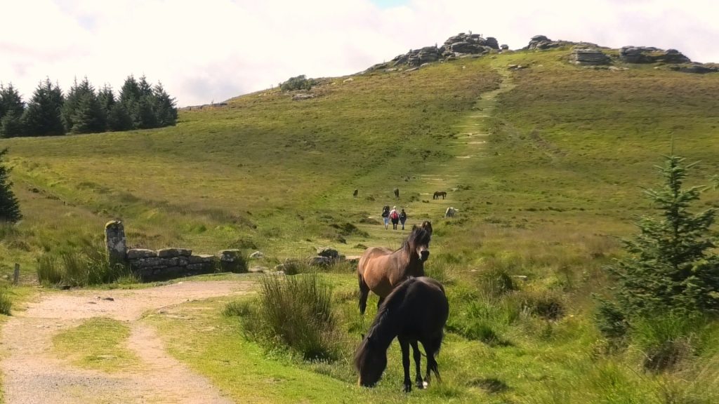
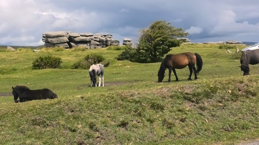
18:37pm – Leaving the main track – 1.45miles to go. I descend the hill, I can see the gate, I pass horses and cows, who don’t know what I have achieved!
18:45pm – I am at the edge of the moor, I still have a little under a mile to go to the college in Ivybridge where I am to be picked up, but I have done it. I have navigated Dartmoor from North to South in a day. I pass through the gate, and stop my Viewranger. Its momentous, a real accomplishment, but as moments go, I am alone and it is severely underrated.
The need to get to that car, shed my backpack and my knee straps and change my shoes seems much more like the finish to me.
08:00am – Monday the 3rd August – I wake, this is a bit of a lie in for me. I don’t often work Mondays, as Don is in the office and I am home with the kids, but today it feels like a Sunday, probably because Don has the day off too.
I feel tender in the calves, but slept like a log. As I sink my first cup of coffee in the kitchen, alone, I transfer yesterdays footage and watch my walk in 3d on Viewranger. It suddenly dawns on me what i have managed to do. Soon have I forgotten the long slog, the monotony of the last 8 miles, and I wonder what I will do next! And when!
